Yesterday, I asked readers how they felt about setting up independent commissions to handle redistricting in each state. Commenter Mitch Beales wrote: “It seems to me that an ‘independent panel’ is about as likely as politicians redistricting themselves out of office. This is the twenty-first century. How hard can it be to create an algorithm to draw legislative districts after each census?” Reader “BobMunck” agreed: “Why do people need to be involved in mapping the districts?”
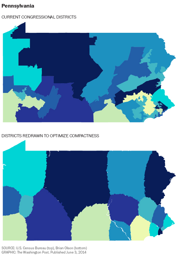
They’re right. These programs and algorithms already exist. Brian Olson is a software engineer in Massachusetts who wrote a program to draw “optimally compact” equal-population congressional districts in each state, based on 2010 census data. Olson’s algorithm draws districts that respect the boundaries of census blocks, which are the smallest geographic units used by the Census Bureau. This ensures that the district boundaries reflect actual neighborhoods and don’t, say, cut an arbitrary line through somebody’s house.
You can see for yourself how his boundaries look.
via This computer programmer solved gerrymandering in his spare time.